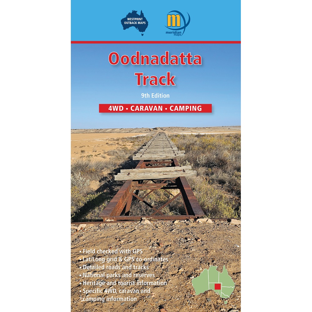
Description Oodnadatta Track Map The Oodnadatta Track Map from Westprint Maps covers Marree, Coward Springs, William Creek, Oodnadatta, Marla, Dalhousie springs, Cadney Park, Level Post Bay, Roxby Downs, Painted Desert, Mt Dare, Old Peake TS, Halligan Bay, and Coober Pedy. The 9th edition of the Oodnadatta Track Map has been significantly updated with more roads named, new reserves shown, more features identified and with revised text on the back. The map covers the Oodnadatta Track from Lyndhurst to Marla via Marree, Lake Eyre, William Creek, Algebuckina Bridge, and Oodnadatta. The Oodnadatta Track closely follows a major Aboriginal trade route, the Overland Telegraph Line and the Old Ghan Line. Add to this unique mound springs, the largest lake in Australia and the biggest cattle station in the world and this becomes one of the most important outback heritage areas in Australia. This map also covers: Stuart Highway between Woomera (Pimba) and Marla, Lake Eyre and the approach to Marree via Leigh Creek. The maps are very clear to read and have road and track distances, rest areas, specific 4WD, caravan and camping information, heritage and tourist information, national parks and reserves, Lat/Long grid and GPS co-ordinates. Photographic references Road cautions Specific landmarks Fuel-food-water Camping & accommodation Emergency UHF radio channels Old Ghan railway Old Overland Telegraph line Contact details Tavellers log Regional roads & tracks